

Trail Maintenance in Collaboration with CCC: Ofunato City—Ayazaki Edition (Part 3)
Starting in September 2025, the California Conservation Corps (CCC) came to Japan to collaborate on maintenance work along the Michinoku Coastal Trail.
https://mct-a.org/activity/10447/
In this post, we’ll provide a detailed report on “Ofunato City: Ayasazaki Part 3” from our trail maintenance project in collaboration with CCC.
Overview
Date and Time: September 24, 2025 (Wed), September 28 (Sun), and September 30(Tue)
Location: Ayasazaki, Ofunato City
Organizer: Certified NPO Michinoku Trail Club
Co-organizer: Ofunato Regional Strategy General Incorporated Association
In cooperation with: NPO Shinetsu Trail Club, Oku Japan Co., Ltd., Japan Airlines Co., Ltd.
Sponsors: Saito Confectionery Co., Ltd., Ofunato Onsen(Kairakuso Co., Ltd.)
Supported by: Ministry of the Environment, Tohoku Regional Environment Office; Iwate Prefecture; Ofunato City; Michinoku Coastal Trail Municipal Council; Sanriku Geopark Promotion Council; Sanriku Railway Co., Ltd.;Tokai Shinposha Co., Ltd., IBC Iwate Broadcasting Co., Ltd.
Participants: Hikers, local residents, local interpreters, CCC, and the individuals listed above
Details:
September 24 (Wed) Trail Survey
September 28 (Sun) Trail Maintenance (“Trail Maintenance Meeting 2025” in Ofunato)
September 30 (Tue) Trail Maintenance
What Is Ayasazaki?
Ryori-zaki in Ofunato City is one of the most spectacular hiking trails, featuring a series of sheer cliffs overlooking the Pacific Ocean.It is known as a challenging hiking trail where visitors can enjoy the dramatic scenery of the rias coastline jutting out into the Pacific Ocean. The place name “Ryori” has a rich cultural background, including a legend that high-quality silk fabrics (ayori) were once produced there, as well as a theory that it derives from the Ainu language.
The Ayasazaki Lighthouse, standing at the tip of the cape, serves as a vital outpost watching over a treacherous stretch of the shipping lane and has become an iconic checkpoint along the trail.Due to the steep terrain characteristic of the rias coastline, the area around Ayasazaki is home to near-pristine forests that have remained largely untouched by human activity, and it is not uncommon to encounter wildlife such as serows, deer, and pheasants along the trail.
In 2025, a large-scale wildfire broke out in the forested areas around Ayasazaki. Driven by strong winds, the fire spread, destroying parts of the precious vegetation, trail surfaces, and informational signs.The trail reopened on June 9, 2025, and hikers are gradually returning. Meanwhile, restoration work is still underway (as of January 2026).
Trail Survey
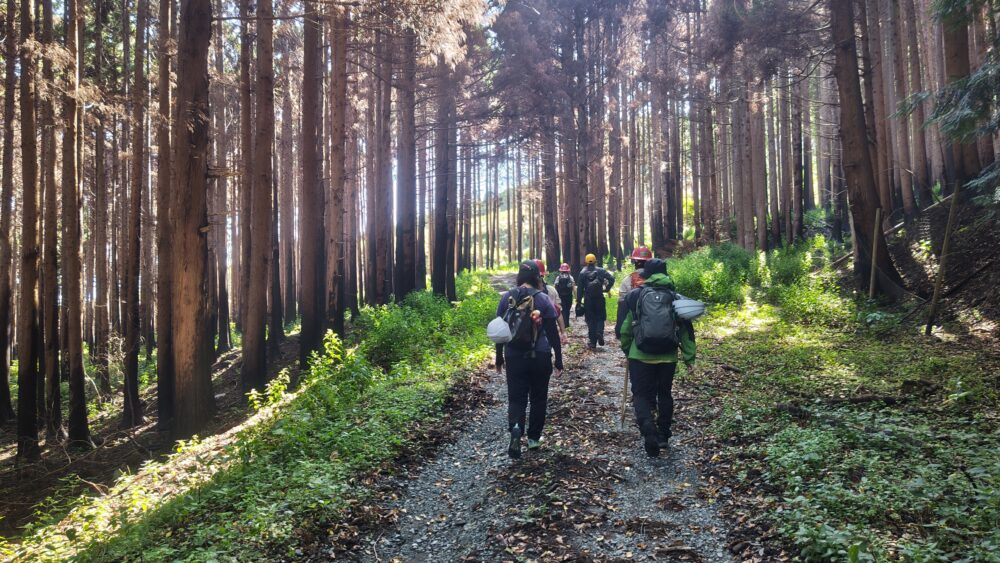
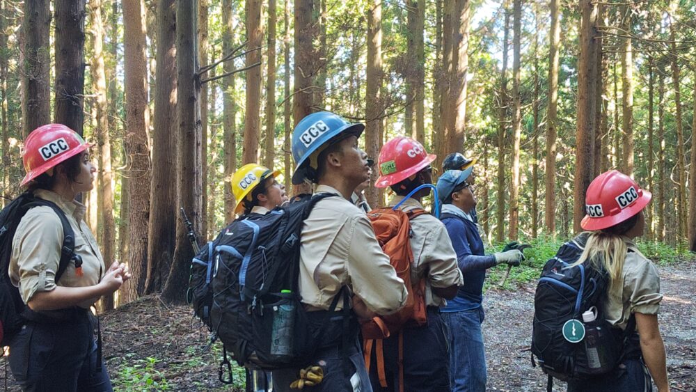
First, we surveyed the trail at Ayasazaki together with members of the CCC.
We had the participants walk around the entire Ayasazaki area while explaining what happened during the forest fire.
Finally, we conducted a detailed inspection of the areas scheduled for maintenance.
Trail Challenges and Maintenance Plans
This time, we decided to perform maintenance on the Tahama district of Ayasazaki.
We performed maintenance on a total of four locations.
Maintenance Area A
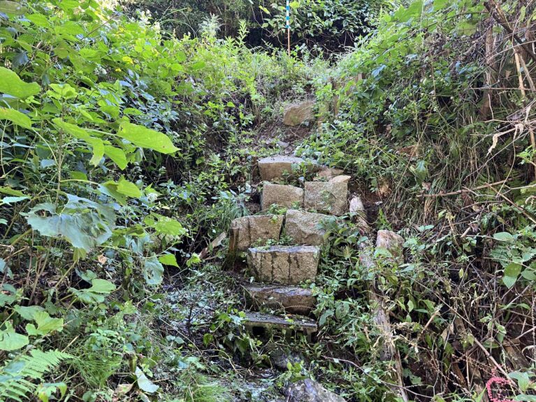
The first area requiring maintenance is this staircase.
Originally, this was just a bare slope, but because of the steep incline and the uneven footing, local residents installed these stairs. Several years have passed since they were installed, and some issues have begun to arise.
The specific issues are as follows:
- Some of the rocks used as steps are unstable in places.
- The stairs are very steep.
- It’s surrounded by thickets.
- A small stream flows into the trail below the stairs.
We have decided to address Maintenance Area A according to the following policy.
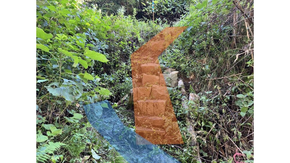
- Trim the surrounding brush as little as possible
- Identify the branching point of the water flowing under the stairs (shown in blue in the figure above) and construct the system so that the water does not flow into the trail.
- Regarding the stairs, reassemble any steps that have become unstable.
- For the stairs, we will add a landing partway up so that they can be climbed in two stages, thereby making the slope gentler.
Maintenance Area B
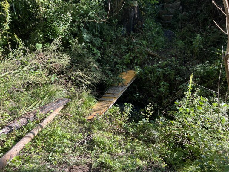
This is the bridge located directly below the staircase we saw earlier.
Just like the stairs, this was installed by a local resident a few years ago.
The middle of the bridge is broken in half, and it sways with every step; it looks as if it could collapse at any moment.
- The lumber used to build the bridge is quite unstable.
- It’s surrounded by thickets.
We have decided to address Maintenance Area B according to the following policy.
- Trim the surrounding brush to a minimum
- Remove the existing bridge and build a bridge made of logs.
Maintenance Area C
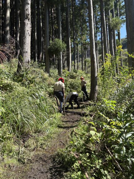
This area has a topography that tends to collect water; water is springing up from the mountainside of the trail (to the left in the photo) and flowing onto the trail.
Because many hikers pass through the area in this condition, the water and sediment are constantly churned up, leaving the trail muddy.
- Water is flowing onto the trail, making the surface muddy.
We have decided to address Maintenance Area C according to the following policy.
- Trim the surrounding brush as little as possible
- Identify the location where water is gushing out
- Install side ditches and drainage channels to drain water away from the trail
Maintenance Area D
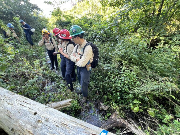
This was the most challenging area among the sites requiring maintenance this time.
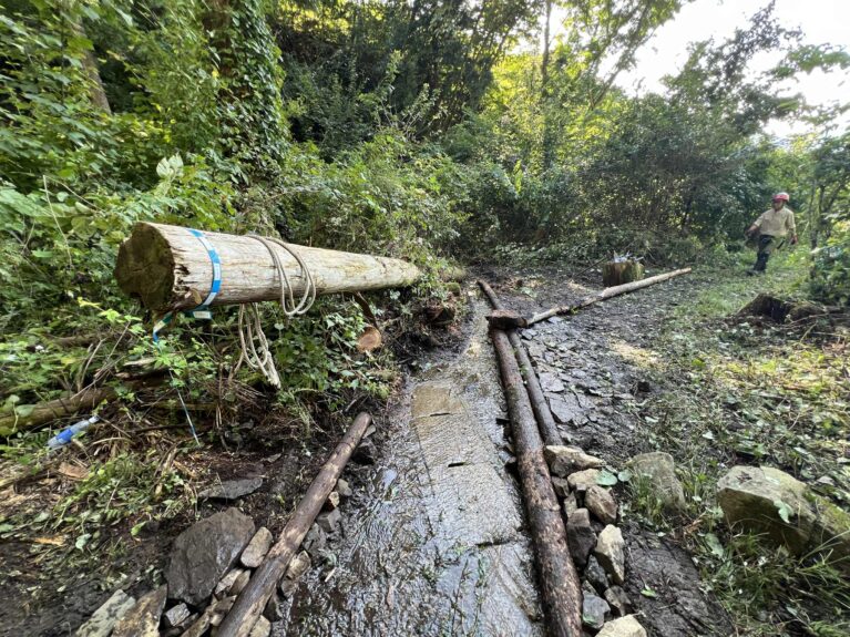
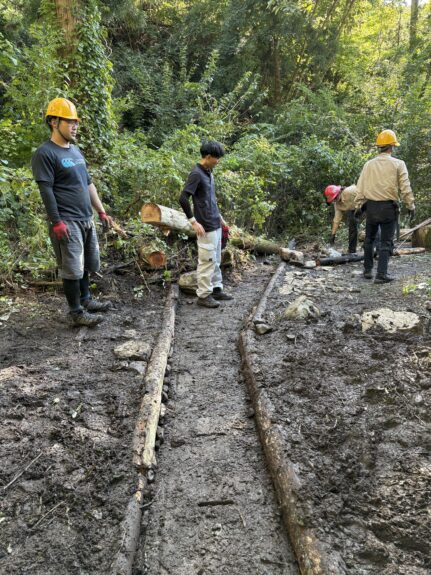
Similar to Maintenance Site C, water is flowing onto the trail here, but the volume is far greater; rather than saying it’s muddy, it might be more accurate to describe it as a small stream flowing across the trail. The area is surrounded by thick brush, and during the survey phase, we were unable to pinpoint exactly where the water was coming from.In addition, large trees and sediment—presumably washed down by the water—have accumulated around the trail.
- A large amount of water is flowing onto the trail.
- It’s surrounded by thickets.
- Large trees and sediment have accumulated around the trail.
We have decided to address Maintenance Area D according to the following policy.
- Trim the surrounding brush as little as possible
- Identify the junction where water is flowing in
- Install side ditches and drainage channels to drain water from the trail
- Remove any large trees or debris that have accumulated and are likely to obstruct traffic
- Spread stones and gravel on the muddy road surface
Maintenance Work and Subsequent Developments
Maintenance work was carried out over two days: Sunday, September 28, 2025, and Tuesday, September 30, 2025.
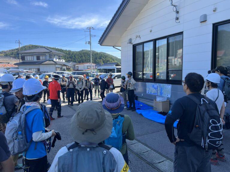
On Sunday, September 28, the maintenance was carried out as part of an event titled “Trail Maintenance Meeting 2025” in Ofunato. Thanks to the cooperation of hikers, local residents, and representatives from numerous companies, municipalities, and government agencies, we were able to complete a significant amount of maintenance work in one go.
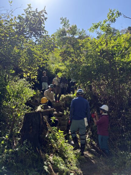
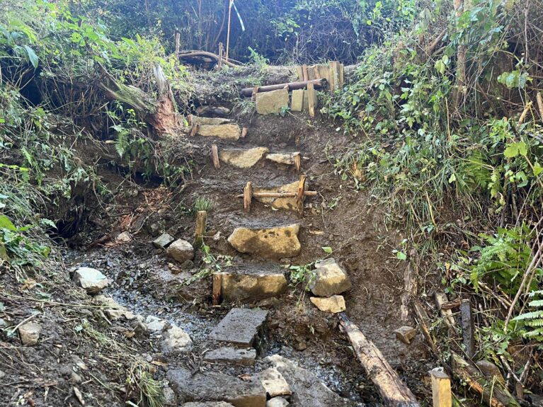
Maintenance Area A
- I trimmed the surrounding brush back to a minimum.
- Regarding the water flowing under the stairs, we looked for a point where it could be diverted, but it was difficult to pinpoint one; moreover, given the terrain, it was challenging to construct the path in a way that would prevent the water from flowing onto the trail. Therefore, we adjusted the waterway and routed it through holes in concrete blocks, designing it so that hikers could walk over it.
- As for the stairs, we had planned to rebuild only the sections that were unstable, but since all of them were unstable, we rebuilt them from the bottom up and packed down the steps with soil.
- Regarding the stairs, we added a landing partway up so they can be climbed in two stages, which made the slope gentler.
September 24, 2025
September 30, 2025
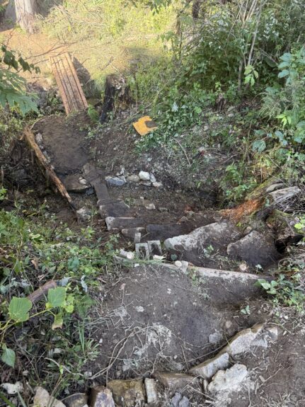
Here is a photo taken from above after the maintenance was completed.
You can see that the steps are now much wider, offering good visibility and making it safer to go up and down.
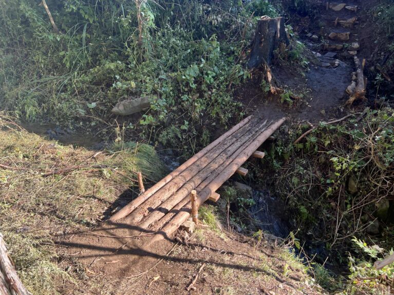
Maintenance Area B
- I trimmed the surrounding brush back to a minimum.
- The original bridge was removed, and a bridge made of logs was installed in its place.
September 24, 2025
September 30, 2025
Maintenance Area C
- I trimmed the surrounding brush back to a minimum.
- We identified the location where water was gushing out.
- We installed side ditches and drainage channels to divert water away from the trail. Although the trail surface is still wet following the maintenance work, we expect it to dry out once the drainage system is functioning properly.
September 24, 2025
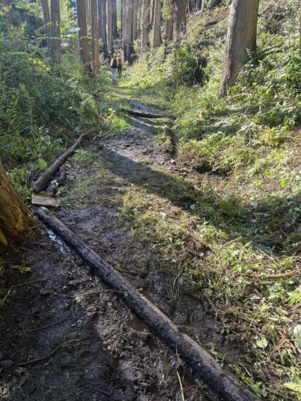
September 30, 2025
Maintenance Area D
- I trimmed the surrounding brush back to a minimum.
- We identified the junction where water is flowing in.
- We installed ditches and drainage channels to drain water from the trail.
- We removed any large trees and debris that appeared likely to obstruct traffic.
- They spread stones and gravel on the muddy road surface
September 24, 2025
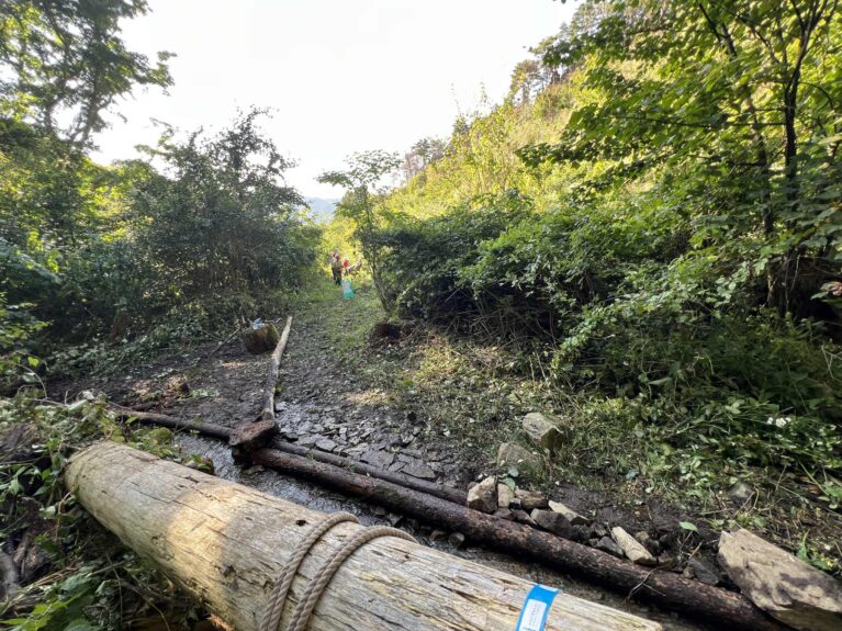
September 30, 2025
On the first day of trail maintenance—the day of the “Trail Maintenance Meeting 2025”—we began by clearing the surrounding brush and removing accumulated sediment. As we continued our work, a U-shaped ditch suddenly came into view beneath the trail.It appears that a river once flowed through this area, and the U-shaped ditch had been installed as a culvert. We tried to locate the inlet and outlet of the U-shaped ditch, but because the brush was thick and there was a significant amount of sediment buildup, we decided to postpone fully mapping the entire structure for the day.We first diverted the water so it would flow into the U-shaped ditch, and then constructed a channel to direct any water that still overflowed into the stream on the valley side of the trail.
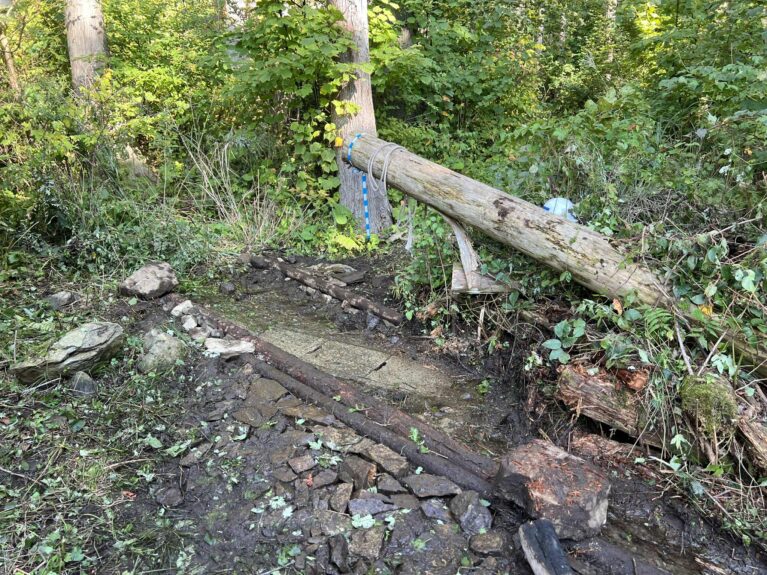
On the second day of trail maintenance, we set out to clear brush and remove accumulated sediment while checking the inlet and outlet of the U-shaped ditch. It was a task with no clear end in sight, so we didn’t know how long it would take, but before long, we found the inlet of the U-shaped ditch.
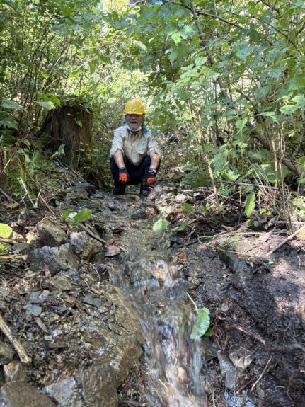
Since we located the entrance to the U-shaped gutter, we cleared the blockage, straightened the waterway, and made the necessary adjustments to ensure that water flows reliably into the U-shaped gutter.The water receded from the trail in no time, and the trail surface gradually dried out. We also installed a drainage channel alongside the U-shaped gutter to prevent water from flowing onto the trail even if the river swells and overflows from the gutter.
September 28, 2025
September 30, 2025
Summary
We’ve shared an update on “Trail Maintenance in Collaboration with CCC: Ofunato City—Ayazaki Edition (Part 3).”
We carefully carried out repairs one by one, including rebuilding the stone steps, replacing a rotted bridge with new logs, and clearing clogged drainage ditches to restore the muddy path.
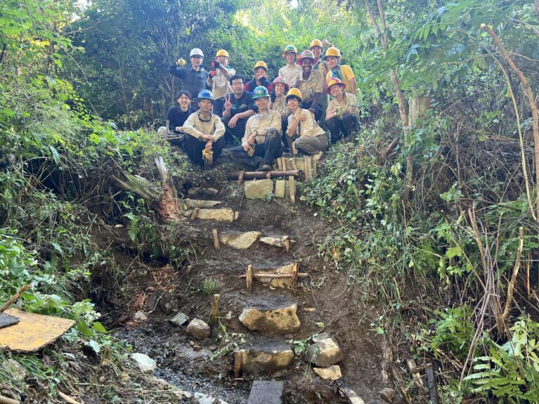
This time, we received cooperation from many people who love this trail, including local residents, hikers, government officials, and corporate representatives. The warm sentiments of everyone hoping for recovery from the forest fire have taken shape, transforming the trail into an even better one.
Article by: Ryota Matsukawa