

Trail Maintenance in Collaboration with CCC: Kamaishi City—Ishizuka Pass, Part 2
Starting in September 2025, the California Conservation Corps (CCC) came to Japan to collaborate on maintenance work along the Michinoku Coastal Trail.
https://mct-a.org/activity/10447/
In this post, we’ll provide a detailed report on “Kamaishi City: Ishizuka Pass, Part 2,” from our collaborative trail maintenance project with CCC.
Overview
Date and Time: September 22 (Mon) – September 23 (Tue), 2025
Location: Ishizuka Pass, Kamaishi City
Organizers: Ofunato Regional Strategy (General Incorporated Association), Michinoku Trail Club (NPO)
Participants: CCC, Kamaishi City, local interpreters, Michinoku Trail Club
Details:
Day 1: Trail Survey
Day 2: Trail Maintenance
Challenges on the Trail
Ishizuka Pass marks the border between the Nanbu Domain (Morioka Domain) and the Date Domain (Sendai Domain) during the Edo period, connecting Hirata and Karato in Kamaishi City, Iwate Prefecture. At that time, both domains maintained “guard posts” to strictly monitor the area, and remnants of the “domain boundary marker stakes” that marked the border still remain on the pass today.During the late Edo period, it also served as the cross-border route for the “Sanbei Uprising,” in which approximately 4,000 farmers from the Nanbu Domain, suffering under heavy taxes, fled to the Sendai domain. Today, it is a popular hiking trail where visitors can experience the area’s rich history.
Due to the effects of Typhoon No. 19 in 2019 and subsequent heavy rains, large water channels have formed along the trail, causing significant landslides in some areas. Several such areas have been identified along the route over Ishizuka Pass, but we have decided to focus on repairing two particularly large landslide sites this time.
Collapse Site A
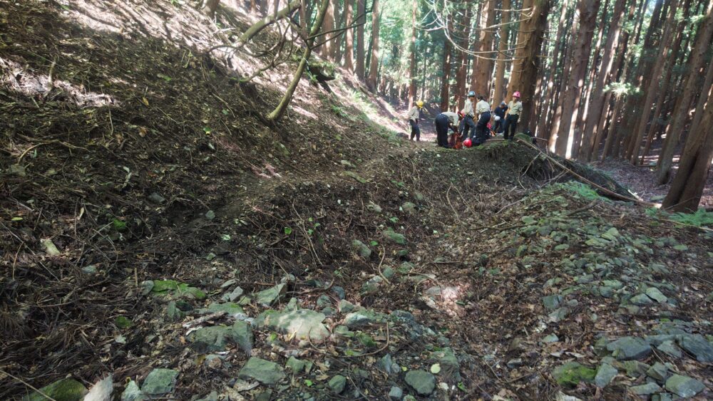
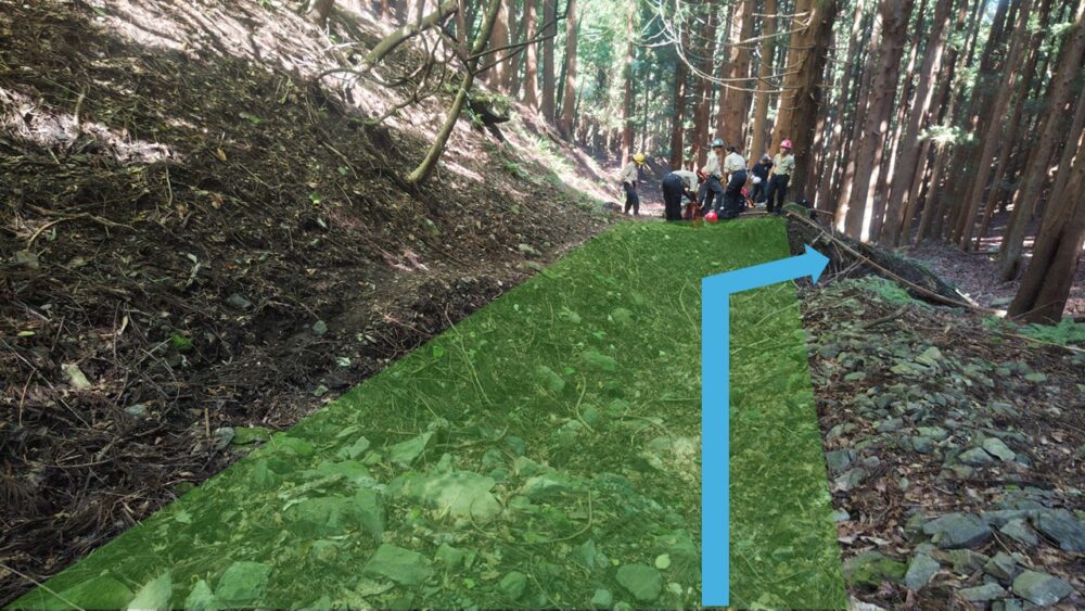
Originally, as shown in the photo below, the area painted green was the trail, but a large waterway has severely eroded it. In particular, where the waterway curves, the trail is directly exposed to the force of the water, resulting in the most severe erosion and creating a gully deeper than a person’s height.Furthermore, even after the water is discharged off the trail, it continues to erode the soil and vegetation until it joins the river at the bottom of the valley. There is a narrow path on the mountainside, but it is so narrow that it is difficult to say it is safe to walk on.
- The soil and vegetation have been damaged
- The walking space is narrow, posing a safety risk to hikers.
- The scenery is being marred
Collapse Site B
-767x575.jpeg)
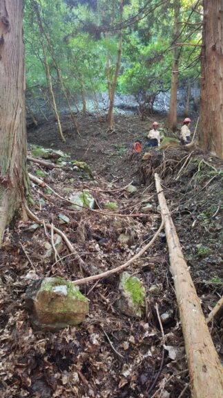
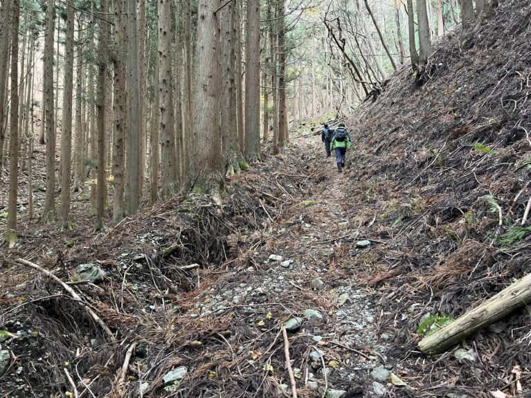
Collapse Site B is located about 100 meters downstream from Collapse Site A.
Here, too, a phenomenon nearly identical to that at Collapse Site A is occurring.
Causes of the Problem
After investigating the surrounding area, the following factors were identified as the likely causes.
- The trail is located in a valley, in an area where water tends to collect.
- The geology is fragile
- The trail itself is steep, so the water tends to flow quickly.
- There are no drainage channels, making it difficult to drain water from the trail
Maintenance Plan
Next, we’ll move on to the maintenance plan.
We have summarized our policy into the following four points:
- Install a drainage system to reduce the amount of water flowing into the trail
- Fill in the eroded areas with logs, rocks, branches, leaves, and other materials to slow the water flow and create conditions for soil to accumulate.
- Separating Waterways and Walkways
- Ensure ample walking space and protect hikers’ safety
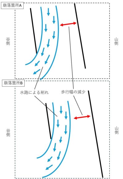
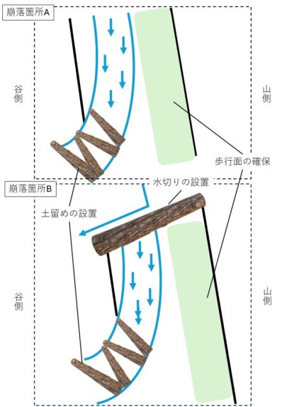
This time, we decided to separate the waterway from the walking path.
Since the mountainside is more susceptible to water flowing down from the mountain slope, it is generally considered preferable to locate the walking path on the valley side of the waterway. However, in this case, we decided to place the walking path on the mountainside due to several factors, including the fact that the waterway has significantly damaged the terrain on the valley side, the terrain’s instability, and the presence of tree roots.
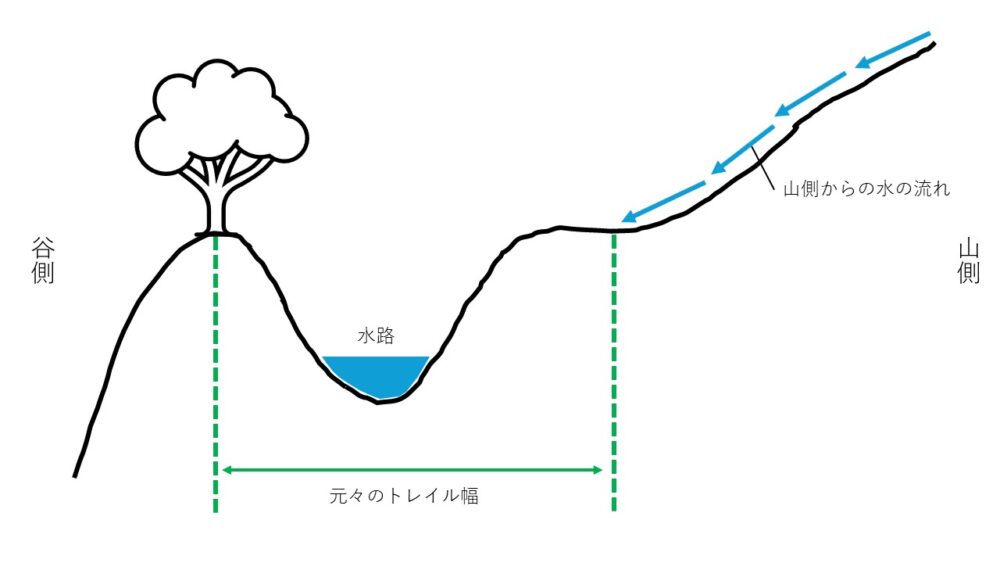
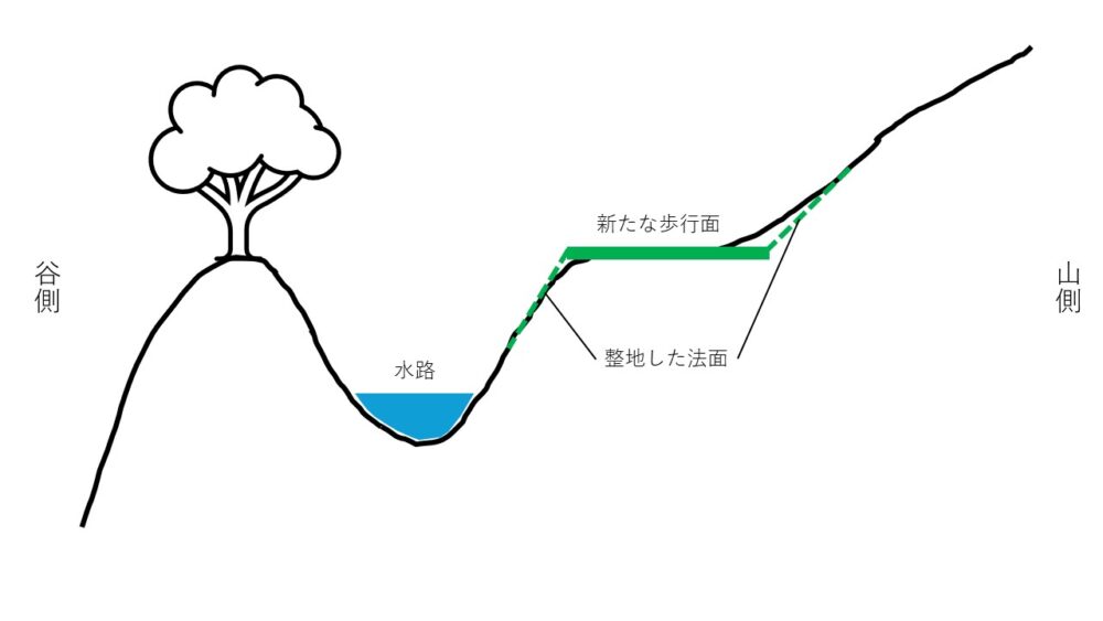
Maintenance Work
We will split into two teams and begin work at Collapse Site A and Collapse Site B.
-767x575.jpeg)
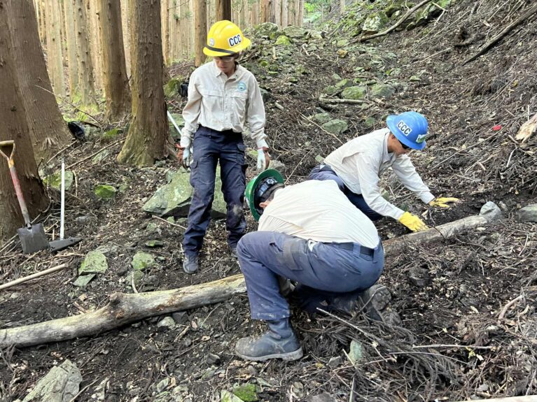
Progress
Since the work was limited to just one day, there was only so much we could do, but I think it served as a temporary fix.
When I visited the site about two months later, I noticed that a small amount of soil had accumulated. Although the terrain hasn’t fully returned to its original state, it remains stable for now.
Collapse Site A
It’s hard to see in the photo, but on the right side, a retaining wall has been built using logs, rocks, and leaves. When I visited two months later, I could see that soil had accumulated there. As you can see in the photo, the terrain in the area where the landslide occurred has recovered significantly.
-767x575.jpeg)
September 23, 2025
-766x575.jpeg)
September 23, 2025
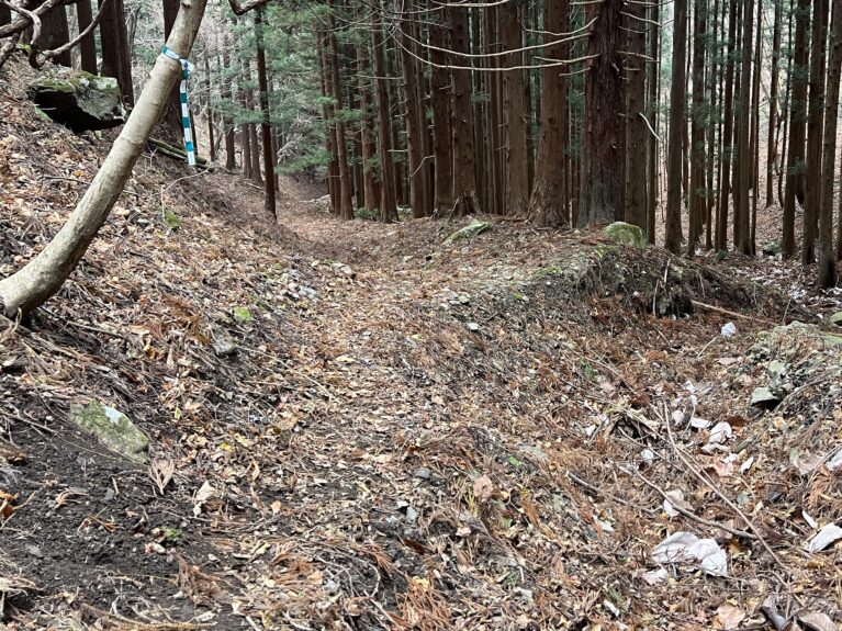
December 2, 2025
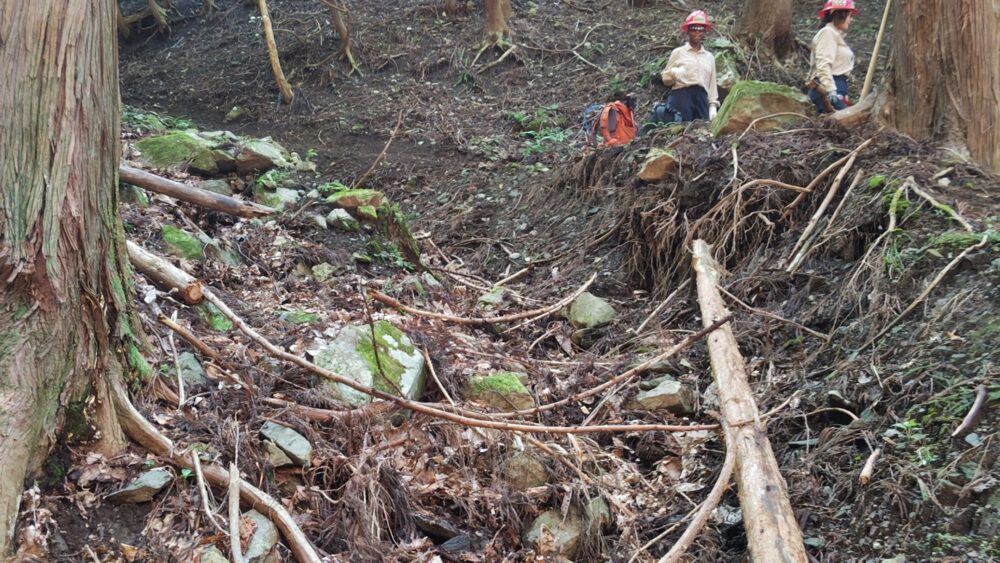
September 23, 2025
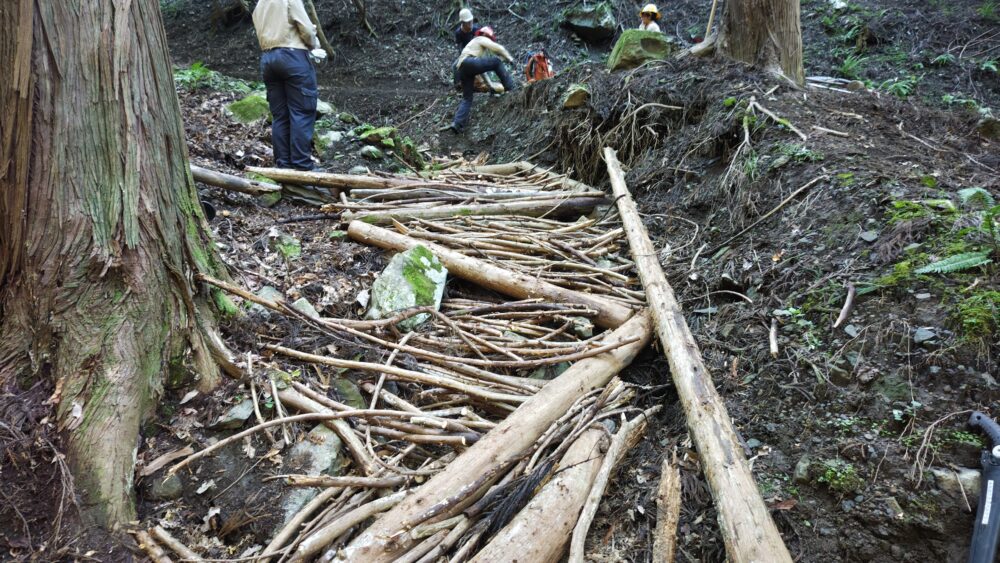
September 23, 2025
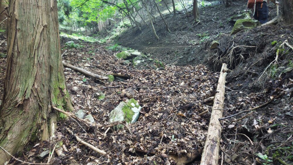
September 23, 2025
Although it isn’t very wide, we were able to secure a stable walking surface. Two months later, it had become buried under branches and leaves and was hard to see. Regular maintenance is necessary.
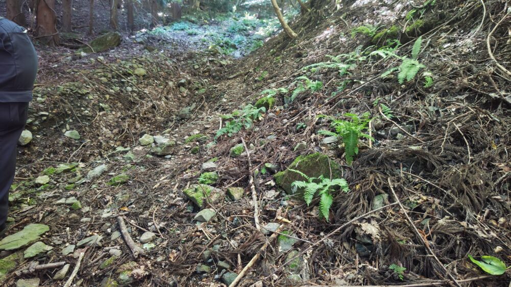
September 23, 2025
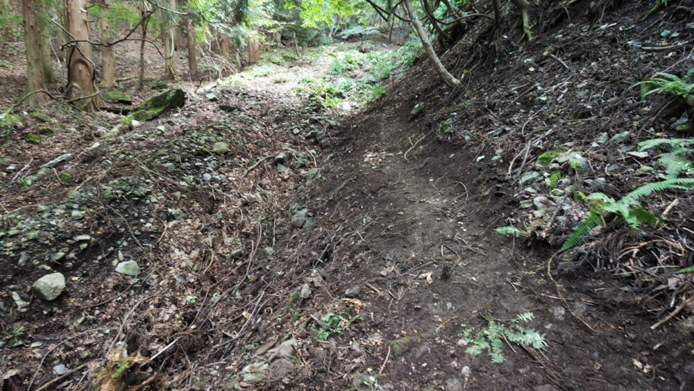
September 23, 2025
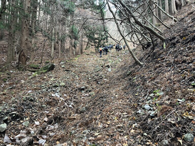
December 2, 2025
Collapse Site B
Similar to Landslide Site A, a retaining structure has been built here on the right side of the photo using logs, rocks, and leaves. When I visited two months later, I could see that soil had accumulated there. As you can see in the photo, the terrain in the landslide area has recovered significantly.
-1-767x575.jpeg)
September 23, 2025
-767x575.jpeg)
September 23, 2025
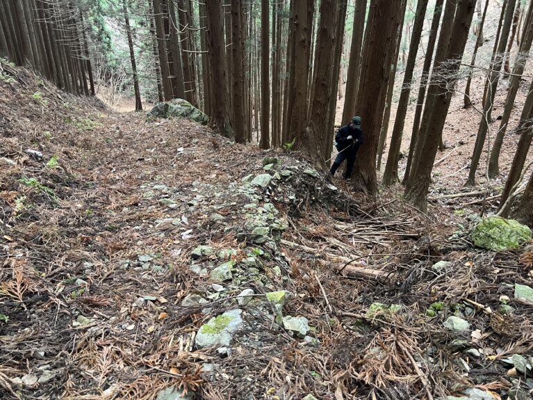
December 2, 2025
We also backfilled the waterway using branches, rocks, and soil removed during the site preparation. Since then, no areas significantly eroded by water have been identified, indicating that the terrain is gradually returning to its original state. Although branches and leaves have accumulated on the walking path, it remains sufficiently wide.
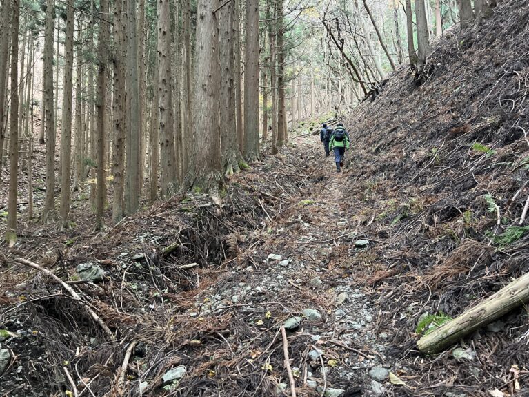
November 29, 2023
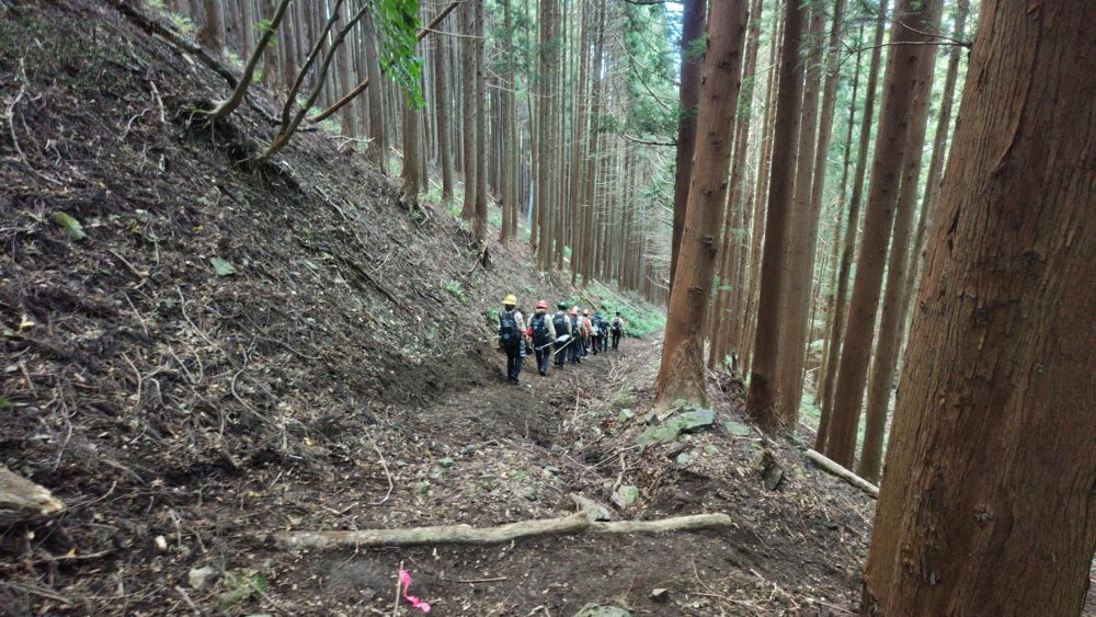
September 23, 2025
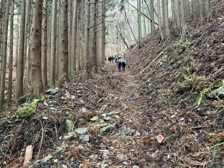
December 2, 2025
Although the water deflector showed no particular abnormalities even two months after installation, leaves and twigs had accumulated on top of it. Since water could potentially overflow the deflector, this area also requires regular maintenance.
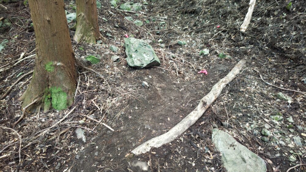
September 23, 2025
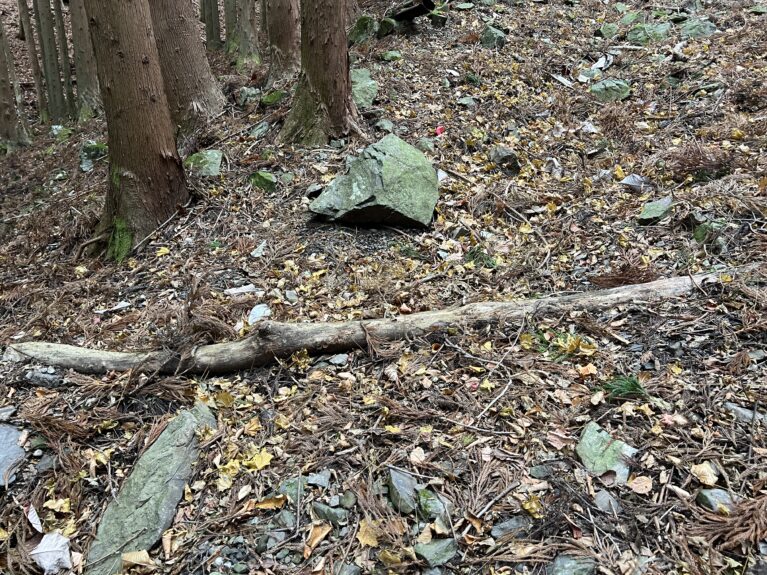
December 2, 2025
Summary
Ishizuka Pass is a trail that people have been using for hundreds of years, and it’s a wonderful place to enjoy a peaceful walk through the forest. At the same time, it is one of the sections of the Michinoku Coastal Trail with the most severe landslides, requiring extensive restoration work. We will continue to prioritize maintenance here so that we can preserve the natural environment and ensure the trail remains a safe place where hikers can connect with nature.

Article by: Ryota Matsukawa